
Trace a Fredericksburg Street Address
Address records answer different questions. FredGIS connects a physical location to a parcel and GPIN, the city identifier used instead of a tax-map number. The Circuit Court Clerk’s index follows recorded land transactions. Historic directories and census material add time and household context. Because Fredericksburg is an independent city, a property in the city is handled through city offices, not through Stafford or Spotsylvania merely because a mailing address says Fredericksburg. For a city property, 22401 is the useful initial check, then the parcel’s situs and legal description confirm the correct jurisdiction.
A Fredericksburg street directory is strongest when its entries are dated and source-specific. Property information can identify an owner or recorded interest, but it does not prove that every person associated with an address is present there. Move from the current parcel outward, preserve the GPIN and document reference, and keep each source’s date beside the result.
- Search the address in FredGIS or select it on the map. Record the situs address, GPIN, parcel outline, owner/property panel, and the date of the search.
- For a street segment, use the map’s buffer or browse tools and export the selected parcel set only after checking that the results fit the intended area.
- Take each GPIN or current owner to the Virginia Secure Remote Access index. Choose Fredericksburg City Circuit Court and use the recommended Last, First name format when a name search is needed.
- Read the acquisition deed or request it from the Clerk. Its grantor, grantee, recording date, instrument number, book/page, and prior reference are the bridge to the earlier record.
- Use statutory voter-list access and historic directories carefully as supporting layers. A public registration entry or directory entry is limited to that source and date, not a full household claim.
Use FredGIS for Fredericksburg Streets
The City’s Property Records service directs parcel research to FredGIS MapInsights. Its current tools support address or parcel navigation, map selection, adjoining-parcel selection, buffers, layers, drawing, measurement, and exports. Parcels, roads, addresses, neighborhoods, wards, historic districts, zoning, parks, and aerial imagery can supply the geographic context for a street-by-street check. FredGIS does not contain tax information, is not a legal description, and is not a survey. Treat its result as the first verified lead, then use the GPIN and clerk record to test it.
See the FredGIS MapInsights parcel viewer before starting a street search.
The viewer’s parcel selection and layer tools give a street search spatial context, while the deed index supplies the recorded transaction trail.
| Map control | Input | Street-directory use | Local limit |
|---|---|---|---|
| Address or parcel search | Text/autocomplete | Find a current parcel or select it on the map | Exact public labels can change in the client-rendered viewer |
| GPIN | Text or result value | Carry the city parcel ID to deed and tax research | Fredericksburg does not use tax-map numbers |
| Buffer | Spatial tool | Query a short street stretch or nearby parcels | Confirm the selected result set before export |
| Adjoining parcels | Map tool | Check parcels directly beside an address | It is a map relationship, not a legal boundary ruling |
| Layers and export | Toggle and button | Compare roads, wards, neighborhoods, historic layers, and aerials | Tax balances are outside FredGIS |
Note: A map result should be saved with its search date because the city says the viewer’s data is updated periodically.
Compare Fredericksburg Street Record Layers
No single Fredericksburg record set functions as a street directory. The map supplies a parcel and its current spatial context. The Clerk supplies recorded instruments. The Commissioner of the Revenue and Treasurer handle assessment and tax questions separately from GIS. The local registrar has a statutory route for public voter-list inspection, with protected fields and protected addresses omitted. CAP supplies permit and inspection context by address. Older directories, newspapers, maps, and census schedules can connect a location to an earlier period. The useful result is a chain of narrow, attributable facts rather than one broad conclusion.
| Fredericksburg record layer | Custodian | Address clue | Access route |
|---|---|---|---|
| FredGIS parcel card | City GIS and Commissioner records | Situs, GPIN, owner/property details, building and land fields, overlays | Free viewer; tax data is separate |
| Assessment or tax account | Commissioner of the Revenue or Treasurer | Assessment, tax year, billing or mailing data where maintained | Office or tax channel; request existing records when appropriate |
| Land-record index and deed | Fredericksburg Circuit Court Clerk | Parties, recording date, legal description, instrument or book/page | Free 22401 index, SRA images, counter, mail, or email copy request |
| Plat or subdivision record | Circuit Court Clerk and GIS | Lot, block, easements, rights-of-way, and subdivision geometry | SRA, clerk counter, and map layers; verify against the deed |
| Public voter list | City Registrar | Allowed registration fields for registered voters | Inspection under Va. Code § 24.2-444, with statutory exclusions |
| CAP permit record | Community Planning and Building | Project location, GPIN, work description, participants, and inspection status | CAP address search or city records request for existing non-court records |
| Historic directory or map | CRRL, UMW, Heritage Center, or city collections | Older address terms, cross streets, business, and local context | Digitized and in-person holdings vary by year |
The city property-records page is the practical handoff point between an address and a GPIN.
The property search establishes a parcel lead. The GPIN and legal description, not an owner mailing field alone, carry that lead into recorded land research.
Carry a Fredericksburg GPIN Into Deeds
Start at the parcel card, then move to the Fredericksburg Circuit Court Clerk’s land-record instructions. The clerk identifies land records, wills and fiduciary records, marriage licenses, judgments, and related filings as city-circuit records. In SRA, choose Fredericksburg City Circuit Court, search a party in Last, First order or use the GPIN, and narrow the record type or date where needed. The city’s land-record groups reach back to 1782, but access is split: free remote searching is a limited 22401 index, while document images require authorized subscriber access or a courthouse visit.
A grantor is the person or entity transferring an interest. A grantee receives it. A recorded deed can carry a prior deed reference, a legal description, and a book/page or instrument number. Those details are more reliable than a bare street-name match when parcels have been combined, divided, or described by lot and block.
| Party role | Grantor or grantee name, used to move backward or forward through a recorded transfer. |
|---|---|
| GPIN | Fredericksburg’s parcel identifier, used to connect a map result with clerk and tax research. |
| Instrument reference | A document number or book/page citation used to request and verify the recorded item. |
| Legal description | The recorded parcel description, such as a lot, block, subdivision, or metes-and-bounds description, rather than a casual address label. |
The clerk’s land-record page explains the local GPIN and SRA method.
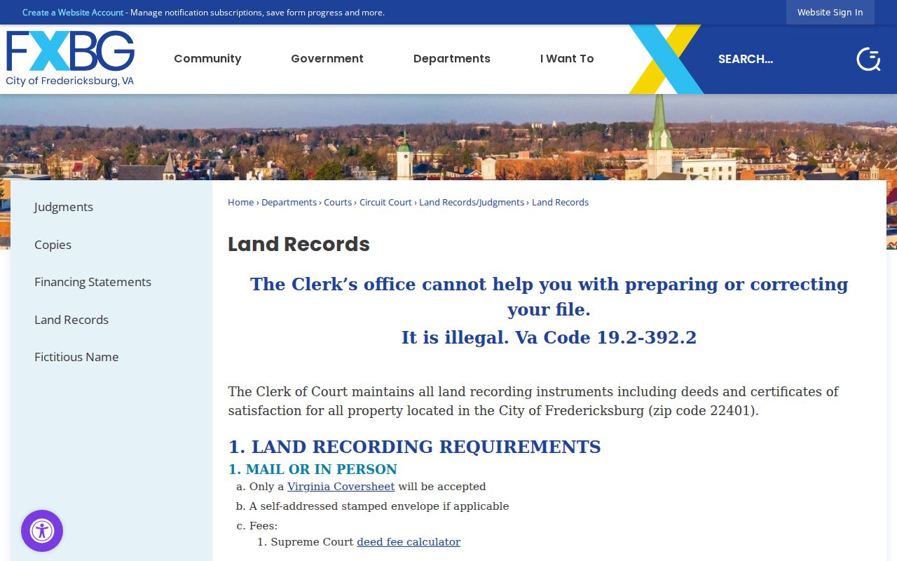
Use an index hit as a lead and read the underlying recorded instrument before treating a transfer or description as established.
CAP Dates Fredericksburg Street Work
The city’s Community Planning and Building CAP system supplies a different kind of address evidence. Its location guidance calls for the street number and the first two or three letters of the street name. Results can concern a project location, description, GPIN, applicant, owner, licensed professional, contractor, plans, fees, or inspection status. That record can date work at a parcel or identify named project participants. It does not establish who was present at the address, and a missing CAP result does not prove that no work occurred.
For records that are not visible in CAP, use the city’s NextRequest public-records route for existing non-court city records. Court and clerk-file access follows the Clerk’s procedures instead. This distinction prevents a street search from sending a deed or estate request to the wrong custodian.
Read Fredericksburg Street History
Modern map results need a historical check before they are projected backward. Fredericksburg’s old grid dates to 1728, and the city expanded through annexations in 1951, 1955, and 1984. The 1984 change added about 4.4 square miles from Spotsylvania. A location now treated as a city parcel may therefore have crossed a boundary or been described through another record geography in an earlier period. A Fredericksburg street directory should use the physical parcel, legal description, cross streets, and maps to bridge that change instead of assuming that today’s city line applies to every older record.
The city maps collection includes city-limits, GPIN, annexation, and historic-map resources. Compare a dated map with the deed’s legal description before joining an older listing to a modern street number. Note: A Fredericksburg mailing ZIP is not enough to establish city jurisdiction, because nearby Stafford and Spotsylvania addresses can use the same city name.
Match Earlier Fredericksburg Street Clues
Before modern numbering, a street location could be expressed through cross streets. Chataigne’s 1888-89 Fredericksburg directory uses terms such as above, below, near, and corner, with abbreviations including ab, bel, nr, and cor. That makes a historical street search a map problem as well as a name problem. Record the wording exactly, identify the cross streets on a period map, and only then compare the place with a numbered address, plat, or census enumeration district.
The historical volumes themselves belong to the Fredericksburg city directory collections. For a street-focused search, use them as dated evidence alongside a parcel chain rather than as a substitute for the current map. The Central Rappahannock Regional Library’s Virginiana Room, UMW digitized resources, and the Heritage Center provide the supporting directory, map, and newspaper context.
Respect Fredericksburg Street Limits
Street and parcel records do not reveal a complete list of people at an address. Property data may identify an owner or mailing contact, while the public voter layer is limited to registered voters and excludes protected information. Virginia motor-vehicle information is privileged under Va. Code § 46.2-208 and the federal Driver’s Privacy Protection Act. Public utility-customer and delivery-recipient lists were not located as city sources. A missing name is not proof that someone is absent, and an address appearing in one index is not proof of current presence.
Virginia’s voter-record rules allow specified public fields while excluding Social Security numbers, day and month of birth, protected residences, and other confidential material. The Virginia Attorney General’s Address Confidentiality Program also permits an eligible participant to use a substitute mailing address. Do not attempt to identify or disclose a protected physical address.
Lawful use. Use Fredericksburg street records for personal, lawful research and respect protected information. Do not use any address or record trail to stalk, harass, intimidate, or harm another person.
Use the Fredericksburg Clerk Counter
When the free index lacks the needed image or an older reference needs context, the Circuit Court Clerk’s counter is the direct fallback. The clerk has computers and paper indexes. Land-record research hours are 8:30 a.m. to 4 p.m., while general office hours are 8 a.m. to 4:30 p.m. Copy requests may be made in person, by mail with an email address and self-addressed stamped envelope, or by email with a phone number. Payment must arrive before release, and the city says phone payment is not accepted. Standard copies are generally $0.50 per page, 11-by-17 copies are $1, and certification is $2.
Fredericksburg Circuit Court Clerk
701 Princess Anne St., Suite 100, Fredericksburg, VA 22401. The clerk holds land records, court files, estate material, and local archives. Use the Circuit Court page for current office information.
For fragile loose papers and historic material, the city archives require an appointment. The Clerk, archives, and Library of Virginia microfilm catalog are the appropriate next channels when a street-directory lead stops at a book, paper file, or older volume.